#NASA animation tracks Tropical Storm Hanna’s progression
“#NASA animation tracks Tropical Storm Hanna’s progression”

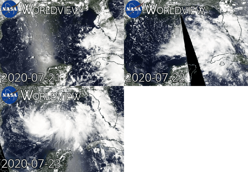
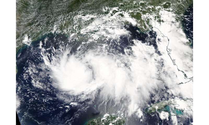
NASA’s Aqua satellite obtained visible imagery as Tropical Storm Hanna formed in the Gulf of Mexico and continued to organize. A new animation from NASA shows how Hanna developed and intensified as it heads toward landfall in Texas this weekend.
NASA Satellite View: Hanna’s Organization
The Moderate Imaging Spectroradiometer or MODIS instrument that flies aboard NASA’s Aqua satellite captured a visible image of Tropical Storm Hanna on July 23 at 1:30 p.m. EDT. The image showed the storm appeared more organized and had a more rounded shape than it did the previous couple of days. That is an indication that the storm was consolidating, organizing and strengthening.
Satellite imagery from the two days before were coupled with the July 23 image and made into an animation using NASA’s Worldview product at NASA’s Goddard Space Flight Center in Greenbelt, Md. That animation showed the clouds associated with the low-pressure area near south Florida and moving west over the Gulf of Mexico where it formed into a depression and further into a tropical storm.
Warnings Posted
On July 24, 2020, the National Hurricane Center posted a Tropical Storm Warning from the mouth of the Rio Grande to San Luis Pass, Texas.
Tropical Storm Hanna on July 24
At 11 a.m. EDT (1500 UTC) on July 24, the National Hurricane Center (NHC) noted the center of Tropical Storm Hanna was located by NOAA reconnaissance aircraft near latitude 27.2 degrees north and longitude 93.2 degrees west. That is 260 miles (420 km) east of Corpus Christi, Texas.
Hanna is moving toward the west-northwest near 9 mph (15 kph), and this motion should continue today. Maximum sustained winds have increased to near 45 mph (75 kph) with higher gusts. Reports from the NOAA reconnaissance aircraft indicate that the minimum central pressure is 1000 millibars.

Hanna’s Forecast Track
The NHC forecast calls for a turn toward the west is expected tonight, followed by a westward to west-southwestward motion through the weekend. Gradual strengthening is expected until the tropical cyclone makes landfall. On the forecast track, the center of Hanna should make landfall along the Texas coast within the warning area Saturday afternoon or evening. Steady weakening is expected after Hanna moves inland.
Citation:
NASA animation tracks Tropical Storm Hanna’s progression (2020, July 24)
retrieved 24 July 2020
from https://phys.org/news/2020-07-nasa-animation-tracks-tropical-storm.html
This document is subject to copyright. Apart from any fair dealing for the purpose of private study or research, no
part may be reproduced without the written permission. The content is provided for information purposes only.
If you want to read more Like this articles, you can visit our Science category.
if you want to watch Movies or Tv Shows go to Dizi.BuradaBiliyorum.Com for forums sites go to Forum.BuradaBiliyorum.Com


