#18 Famous landmarks in Utah

Table of Contents
“#18 Famous landmarks in Utah”
This article of the American Landmarks series scrutinizes the most famous landmarks in Utah. From the world-famous great salt lake and the Bonneville salt flats to the National parks, Utah has abundant natural wonders and a few impressive human-made landmarks. As usual in these posts, we invited a few fellow bloggers to share some of their favorite Utah landmarks.
The Mormons and the snow are some of the numerous things Utah is famous for. Yet, the landmarks in Utah are majestic and contribute significantly to Utah’s reputation as a prime outdoor destination in America. If you love outdoor travel, visiting Utah will surprise you with its distinct and majestic views.
So, without further ados, let’s unravel some of the most famous landmarks in Utah.
Famous landmarks in Utah – Salt Lake City vicinity
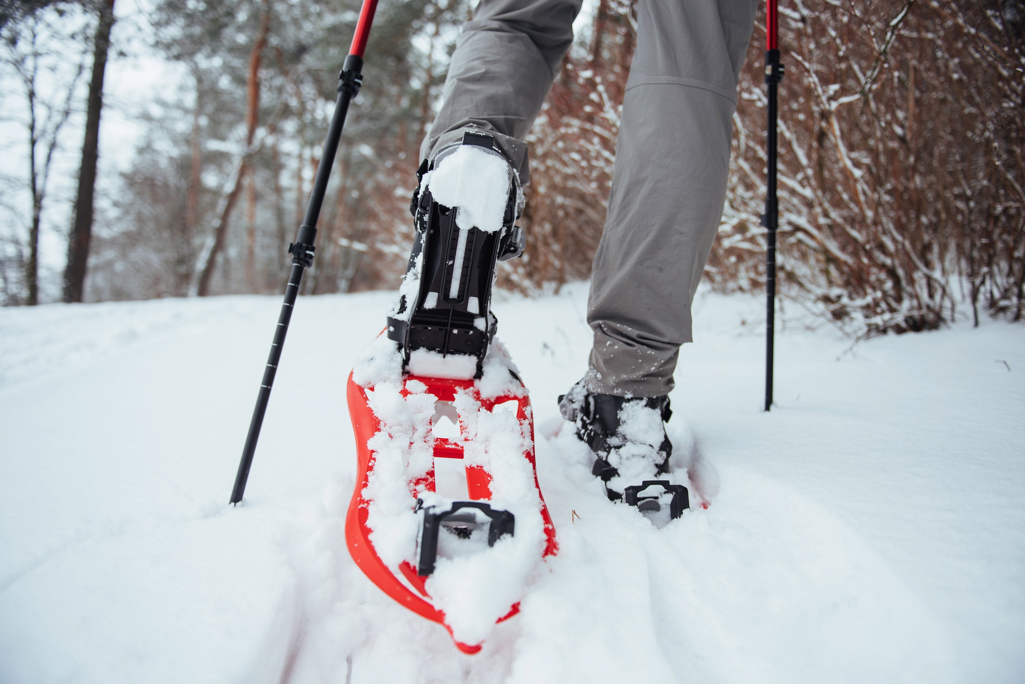
Park City Mountain
By Candice from CS Ginger
Park City is a historic, mountain town just east of downtown Salt Lake City. Park City is a popular winter destination because of the world-famous ski resorts. During the summer months, you will find a buzzing downtown area, beautiful hiking and mountain biking trails, and fun activities at Park City Mountain Resort. There are so many fun things to do in Park City.
There are lots of fun things to do year-round at Park City Mountain. The mountain has about 400 miles of trails for mountain biking and hiking. There is also ziplining, a mountain coaster, and other family-friendly activities. During the winter months, you can cross-country ski, go on a dog sled ride, ice skate, and ski.
Park City was the host venue of the 2002 Winter Olympics. At Utah’s Olympic Park the ski jumping, bobsled, skeleton, and luge events were held. Today, there are lots of activities you can participate in at Olympic Park. You can ride in a bobsled, go ziplining and walk through the museums.
Park is about 40 minutes from downtown Salt Lake. If you are flying into Park City, the closest airport is the Salt Lake City International Airport. You will either need to rent a car to get there or take the shuttle from Park City to Deer Valley Resort. Uber and Lyft are also popular in the area.

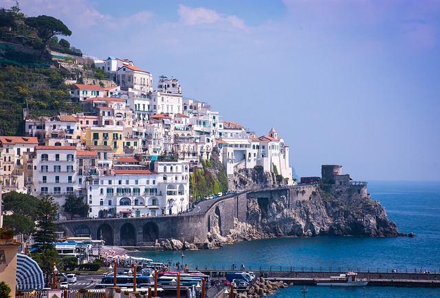
Temple Square
By Rachelle Gordon from Aventure is never far Away
It’s impossible to come to Salt Lake City and never step foot in Temple Square.
Not only was Salt Lake City originally designed with Temple Square at the epicenter, but the buildings and grounds are beautiful. Visiting Temple Square is free of charge and open every day.
Temple Square is always listed in the “top things to do in Salt Lake City” lists from some of the most popular websites online, and for good reason. Temple Square is the headquarters for The Church of Jesus Christ of Latter-day Saints (Mormons) and has various monuments and historical buildings that tell the story of the founding of Salt Lake City.
Take a selfie and marvel at the gothic architecture of the Salt Lake City Temple, the focal point of Temple Square, knowing that it took 40 years to complete: the groundbreaking took place in 1853, after the Mormon Pioneers arrived in the Salt Lake Valley, and wasn’t completed until 1893!
Please kindly remember that this location is a special religious site for members of The Church of Jesus Christ of Latter-day Saints and should be treated with respect.
Temple Square is currently going through a 4 year-long renovation project, scheduled to be completed in 2024. Some buildings and access points might be affected during your visit, but it is worth a visit regardless.
Address: 50 N Temple, Salt Lake City, UT 84150

Spiral Jetty
By Rachelle Gordon from Aventure is never far Away
The Spiral Jetty is one of the most unique art installations that you’ll come across. Built in 1970 by Robert Smithson, the Spiral Jetty is composed of 6,000 tons of black basalt and dirt and is assembled into a spiral shape on the northern shores of the Great Salt Lake.
The Spiral Jetty isn’t just a marvelous piece of art to simply look at, but something to spark a conversation. Robert Smithson created the piece of art as a way to express himself and fall in line with the architectural trends of the 1970s, which greatly contrasted the brightly-colored decade.
Now is the perfect time to visit the Spiral Jetty. The art installation has started to show its age: rocks are worn down from constant foot traffic, erosion, time, and salt from the Great Salt Lake.
To reach the Spiral Jetty, you’ll need your own vehicle that can handle rough and rugged roads. There are no other means of accessing this art installation. You can simply put “Spiral Jetty” into your GPS and start heading north. The Spiral Jetty does sit on the shore of the Great Salt Lake, so bring your water-proof boots if you want to dip your feet in the lake!

This is the Place Monument
By JJ & Brittany from The Minivan Bucket List
Before Utah became a state, it was first settled by members of The Church of Jesus Christ of Latter-Day Saints (incorrectly known as Mormons) fleeing religious persecution. The first pioneers arrived in the Salt Lake Valley in July 1847, and chose it as their new home when Brigham Young, the leader of the church at the time, declared, “This is the place.”
Today, there’s a large 60-foot tall monument standing at the base of Emigration Canyon, where the pioneers first entered the valley. It was completed in 1947 at the centennial celebration of the arrival of the pioneers to Salt Lake. Atop the monument stands sculptures of Brigham Young and two other church leaders. At the base of the monument are more sculptures honoring other explorers and settlers of the American West, like the infamous Donner Party and the Dominguez-Escalante expedition of Spaniards that explored the area in 1776.
The area around the monument is home to This is the Place Heritage Park, which is a small village of shops and interactive exhibits that take you back in time to the pioneer era. There’s a blacksmith, a saddle maker, pony rides for the kids, Native American dancers, and more. If you enjoy learning about the history of the places you’re visiting, then be sure to add This is the Place to your Utah Bucket List.
Utah landmarks – Around Moab
Delicate Arch, Arches NP
By Meg from Fox in the Forest
Delicate Arch is easily one of the most famous Utah landmarks of them all. And if you don’t understand why just look at a Utah license plate and you’ll see it there in all its glory. But, if you want to admire this awe-inspiring natural rock formation for yourself, head to Arches National Park and catch the trailhead along Delicate Arch road, just 18 miles from Moab.
If you can, try and time your delicate arch hike for sunrise. Otherwise, arrive no later than 7:30 am since crowds regularly inundate the area. Once on the trail, it’s an easy to moderate 3-mile round trip hike from which you can admire sweeping panoramas from Slickrock Hill, Ute petroglyphs from a side trail, Wolfe Ranch homestead (on a side trail at the start of the hike), and Frame Arch.
However, the real highlight of this climb is a view of the world-famous Delicate Arch. It’s an inspiring, natural arch that sits quietly in a stunning, slick rock bowl. It stands alone, overlooking the austere La Sal Mountains, and beautifully frames some of Moab’s finest natural landscapes with delicate grace.
As a result, Delicate Arch should be on any Arches National Park itinerary and is a total must-see in the state of Utah.

Dead Horse Point, Moab
By Nikki from She Saves She Travels
One of the best things to do in Moab and a famous Utah landmark is Dead Horse Point State Park. It lives in the shadows of the nearby Arches National Park and Canyonlands National Park and for this reason, it sees far fewer visitors than its neighbors.
It’s just a quick, 30-minute drive from Moab to the park entrance. From there, use the main road to drive past the visitor center to see the famous Dead Horse Point. You’ll get expansive views of a 2,000-foot canyon overlooking the winding Colorado River.
The park offers camping, hiking, photography, and epic stargazing. For hiking, the West Rim Trail and East Rim Trails provide excellent views of the canyon and river while hiking along the edge of the canyon walls.
There are many legends of where the name, Dead Horse Point, originated from. The most prominent theory is the point is where ranchers would corral wild horses and select the ones they wanted and let the others roam free. For some unknown reason, one time the ranchers left them and many horses died.
Regardless of if the legends are true, this is a great spot to visit in Utah, and a sight worth seeing as it’s simply breathtaking.

Corona Arch, Moab
By Kate and Jeremy from Our Escape Clause
Located just outside of Moab, Corona Arch is an impressive Utah landmark–and unlike many natural attractions in Utah, this one is not located in a national park!
At 105 feet tall, Corona Arch is outstanding, and hiking the Corona Arch trail is one of the most memorable things to do near Moab.
The hike itself is about 1.5 miles each way and takes place on BLM land.
The trail is varied and memorable, featuring everything from a railroad track crossing to views of the Colorado River to some very mild scrambling.
When hiking, you’ll spot the arch far before you reach it, but be sure to hike all the way through it–the views are even more impressive on the opposite side of the arch.
Once you finish visiting Corona Arch, there is an option to add Pinto Arch to your hike as well.
The detour will take about 30 minutes, give or take, and while Pinto Arch is not as impressive of a landmark as Corona Arch, it’s still absolutely worth visiting!

Newspaper Rock, Moab
By Daria Bachmann from The Discovery Nut
Located just outside of the Needles section of the Canyonlands National Park, Newspaper Rock State Historic Monument is one of the best places to visit in the Moab area.
Newspaper Rock is a large panel with hundreds of petroglyphs carved in the rock by the Native American tribes including Anasazi, Pueblo, Navajo, and Fremont who once’s called this area home. The carvings are considered one of the largest collections of petroglyphs in the world dating back 2,000 years and depict various figures, animals, and household objects.
The panel is located in a remote area and can be accessed via Highway 211 that also leads to the Needles District of the Canyonlands National Park.
Newspaper Rock is part of the Bears Ears National Monument and is free of charge. The site is open year-round and is one of the best places in the area if you want to see a place off the beaten path.
There are no facilities in the area except for a small parking lot and a few picnic tables.
The closest town to Newspaper Rock is Monticello. Drive north on US-191 from Monticello and make a left turn on Utah Highway 211 which will lead you to Newspaper Rock.
Landmarks Utah – Zion National Park
Angel’s Landing, Zion NP
By Stephanie Rytting from The Unknown Enthusiast
Angel’s Landing is a contender for the most famous hike in Utah – scaling the mountain to the summit while clinging to chains is an epic, bucket-list-worthy adventure!
Situated in southwest Utah, Angel’s Landing is the premier hike in Zion National Park, and its reputation is well-deserved. Following a traditional start to the hike, you reach the first unique feature as Walter’s Wiggle puts a new spin on “switchback”. At the top of these incredibly tight, steep turns, you reach a saddle (bathroom included), and here the real fun begins.
The trail now becomes extremely narrow and sheer, leading you across narrow ridges and what feels like straight up the mountain. Honestly, you feel a bit like a mountain goat, climbing on the face of a steep spit of land. Thankfully, there are chains set up along the entire path to provide some safety and balance.
The hike is strenuous but doable. You do not need to be crazy fit to do this hike – a moderate level of fitness will suffice. And the views at the top are breathtaking! You get 360 degree views over the canyon and every direction is stunning.
Be aware that due to crowds, starting in January 2022, you will need to make a reservation to do this hike. Also, unless visiting in winter, know that you ride a shuttle to the different trailheads.

Zion-Mount Carmel Scenic Highway and Tunnel
By Katy from A Rambling Unicorn
Most visitors to Zion National Park are there to marvel at the magnificent sandstone canyons carved by the Virgin River. Not all of the amazing landmarks in Zion are naturally occurring, however. An engineering masterpiece, the Zion-Mount Carmel Scenic Highway is a dizzying 25-mile (40 km) stretch of road that climbs the side of the canyon and connects Zion with Bryce National Park and the Grand Canyon.
Constructed in 1930, the highway is listed on the National Register of Historic Places. It is also recognized as a National Historic Civil Engineering Landmark. Even if you can only spend one day in Zion National Park, driving the Zion-Mount Carmel Highway should be on your priority list.
The highlight of the scenic drive is the Zion-Mount Carmel Tunnel. At 1.1 miles (1.8 km) in length, it was the country’s longest non-urban road tunnel at the time of its creation. The tunnel features six large galleries that were used during construction to dispose of rock and debris. Today, these windows provide light and ventilation to the tunnel’s interior.
Please note: oversize vehicles are required to obtain a special pass before entering the tunnel so that park rangers can shut down two-way traffic.

The Narrows, Zion National Park
By James Ian from Parks Collecting
The Narrows is a famous slot canyon in Zion National Park. At its far end, the main Zion canyon narrows until there is little space left for anything other than the river. This section, called “The Narrows” for obvious reasons, is home to one of the most famous hikes in the country.
The hiking trail is the river. You need to wade in knee-to-thigh high flowing water, crossing from one narrow pebbly beach to another, as the canyon gets narrower and steeper. In the spectacular Wall Street section, the canyon walls tower hundreds of feet above you and yet are just a few feet apart.
There are two ways to hike through the canyon. The Top-Down method requires you to be dropped off at the far end of the canyon and you then spend two days hiking the entire Narrows, camping overnight on a tiny beach along the way. The much more popular Bottom-Up approach is an out-and-back hike that you can make as short or as long as you like, though Wall Street is a common turning-back point. To get there, take the Zion shuttle to the end, then walk the short Riverside Walk to the start of the Narrows.

The Subway in Zion National Park
By Agnes from The Van Escape
The Subway (official name: Left Fork of North Creek) is a small canyon with a unique oval tunnel shape in the Zion Wilderness in Zion National Park, Utah. The Subway hike is one of the best treks and adventures in the park.
There are two different ways to explore the Subway: canyoneering or hiking. A Wilderness permit is required for both adventures. The permit application process is the same for all going into the Subway. All trips into the Subway require extensive route finding. What’s more, it is a day-use only area, and overnight camping is not permitted.
The Subway Top-Down Canyoneering Route is a brutal 9.5-mile through-hike. In addition, it requires rappelling skills, a 60-foot rope, and extensive route-finding experience. The route also requires swimming through several deep pools of cold, boulder-filled water.
The Subway Bottom-Up Hiking Route is a challenging hike but more manageable than the Top-Down route. It is a strenuous 9-mile out-and-back hike. You will have to find a path, hike in ankle to knee-deep water, and climb over large boulders. But with the proper preparation, it is possible to do this hike. It’s worth setting out early in the morning. Wear waterproof boots with excellent grip and neoprene socks. Keep your photo gear and belongings in a waterproof backpack in case you slip in the water. Also, pack high-energy snacks and an adequate supply of water.

Other Famous Natural Landmarks in Utah
Cassidy Arch, Capitol Reef National Park
Christina Román of Explore now or never
Capitol Reef National Park is truly one of the top highlights on a Utah National Parks road trip. This beautiful park doesn’t get the love it should from tourists. In fact, many people drive the Scenic Drive on their way to more famous places like Arches, Zion, and Bryce National Parks.
But with its steep cliffs, canyons, domes, and bridges, it’s breathtaking! And nothing compares to the grandeur of the natural sandstone Cassidy Arch here. Named after Butch Cassidy, it towers 400 feet above the Scenic Drive with unforgettable panoramic views of the valley below.
The best way to fully appreciate the scale of this natural wonder is to hike the Cassidy Arch Trail. Hikers will earn this view by climbing 666 feet in elevation over numerous switchbacks. It’s a strenuous 3.1-mile out-and-back hike that takes a little under two hours total.
The best way to celebrate your ascent? Stop for a world-famous slice of homemade pie at nearby Gifford House in the tiny town of Fruita…within the park. It’s a historic home once occupied by early Mormon settlers. Today, bakers from nearby Torrey deliver pies daily for famished hikers.

Natural Bridges National Monument
By Lotte from Gezond Weekmenu
Natural Bridges National Monument is located in Southeast Utah, about 38 miles west of Blanding and a 2-hour drive from Four Corners Monument (where the four states of Utah, Colorado, New Mexico, and Arizona come together).
As with most National Parks, you need your own wheels to get there and to get around the park. The Bridge View Drive is a lovely 9mi loop leading to the main highlights of the park.
However, be sure to get out of your car and explore the park on foot as well. Give yourself at least half a day and preferably the entire day when visiting Natural Bridges.
This area has been inhabited by the Anasazi Indians for ages and as such it’s only fitting that the three natural bridges in the park go by beautiful Hopi names (the Hopi tribes are thought to be descendent from the Anasazi Indians):
- Kachina, meaning ‘dancer’
- Owachomo, meaning ‘rock mounds’
- Sipapu, meaning ‘the place of emergence’
While the bridges may look fragile, they’ve stood the test of time. That being said, these natural bridges are still subject to erosion and as a result, Owachomo Bridge is only 9 feet wide in the middle.
If your Utah itinerary allows it, spend the night at the Natural Bridges campground ($15 per night). As an International Dark Sky Park, you’ll be spending the night stargazing and marveling at the clear night skies.

Cedar Breaks National Monument
By Ladona Stork from Walking The Parks
Cedar Breaks National Monument is breathtaking with its dramatic landscapes. There are two sections to Cedar Breaks National Monument – the amphitheater and the high country.
The amphitheater is a giant bowl where uplift and erosion activity have combined to form a 180-degree view of colorful rock formations. This natural amphitheater is 3 miles across and 2,000 feet deep. The red, yellow, purple, and pink cliffs are wondrously eroded into arches and knobby shapes called “hoodoos”. Bring your binoculars so you can see the unique shapes deep in the bowl.
The high country is home to a fir and spruce forest. The meadows are filled with colorful wildflowers in the summertime. There’s a 7.5-mile scenic drive through this region and hiking trails if you’re up for the fresh mountain air.
Cedar Breaks is an official Dark Sky Park where you can see vivid night stars unobstructed by city lights. Stargazing is enjoyed at Sunset Overlook, located at the end of a wheelchair-accessible 2-mile trail. There’s also plenty of winter activities to enjoy, like cross-country skiing and snowshoeing.
Located 4 hours south of Salt Lake City, just off Interstate 15, Cedar Breaks is the perfect stop on your way to Bryce Canyon National Park.

Bryce Point, Bryce Canyon National Park
By Krystianna from Volumes & Voyages
Easily one of the most famous Utah Landmarks, Bryce Point in Bryce Canyon National Park. Visiting this viewpoint is one of the best things to do in Bryce Canyon and absolutely can’t be missed. It’s one of the highest viewpoints in the entire park and allows you to see the most hoodoos at once, which is why it’s so famous.
Plus, the sunrise from this spot is absolutely unbeatable, even though most people head to Sunrise Point instead! You can avoid the crowds by catching the sunrise here, and the spot is very accessible.
To get to Bryce Point, head to Bryce Canyon National Park and drive the scenic road until you get to the pull-off as you start to head further up the mountain. It’s impossible to miss as the park is very well marked and there is a parking lot right at Bryce Point.
Because it’s located inside a national park, you do have to pay the Bryce Canyon National Park entrance fee to get inside. However, if you know that you’ll be frequenting more than two parks in a year, it’s worth investing in the “America the Beautiful pass” for $80 which can be purchased online or at a local REI. It more than pays for itself!

Bonneville salt flats
By Jessica Schmit from Uprooted Traveler
The Bonneville Salt Flats are an otherworldly gem, located 111 miles west of Salt Lake City and a must-stop site on any Utah road trip. The salt flats were formed when an ancient body of water, Lake Bonneville, dried up, leaving behind 30,000 acres of unusually flat land, whose salty soil resembles perfectly white snow across a frozen lake.
Given its unique flatness, the area is home to the Bonneville Salt Flats Race Track, where multiple land speed records have been broken (including a rocket-powered vehicle that sped over 620 miles per hour!). Even if you’re not a racing buff, the salt flats’ geometric appearance makes it worth the trip.
The most photogenic spot to see the flats is the westbound Bonneville Salt Flats Rest Area along Interstate 80, where the ground has the consistent appearance of a cracked martian landscape. For the full Bonneville Salt Flats experience, most passenger vehicles can drive just fine on them, although be sure to avoid the flats after any kind of rain- it becomes soft and pliable and you’re likely to get stuck!
While the rainy season (March through April) will prevent you from driving on the flats, it can provide an excellent opportunity for photography enthusiasts- the thin layer of water across the flat land creates a mesmerizing mirror effect with the sky.

Moqui Caverns
By Val Pope from Voyages with Val
Moqui Caverns is a super unique landmark in Utah near the town of Kanab. The Moqui Caverns are a series of sand caves that require a short hike to access, off of US-89. The sand caves were man-made from a sand mining process, but were left behind and now make a fun spot to explore in Utah on your Southwest trip.
The trailhead is only 7 miles from Kanab, up US-89, and 24 miles from Zion National Park. The actual trail is only 0.5 miles, but it does require a bit of a scramble to get up to the caves. This might make it a difficult hike for some, but wearing shoes with good traction will help.
The route can be a little hard to find, so it is a good idea to print out or download a map of the trail beforehand. The caves themselves are made of sandstone, and the floor of the caves is entirely made of sand. There are several arches around the cave that you can look out of over the desert and surrounding area.

Pin it for later

If you liked the article, do not forget to share it with your friends. Follow us on Google News too, click on the star and choose us from your favorites.
For forums sites go to Forum.BuradaBiliyorum.Com
If you want to read more Like this articles, you can visit our Trip & Travel category.